St Duthac’s Way
Part of Routes and photos
Description
The route from Aberdeen to St Andrews forms the second part of an expanded route which starts at Tain (Gaelic: Baile Dubhthaich, ‘Duthac’s town’), the shrine of St Duthac there being another former pilgrimage destination of some importance, hence ‘St Duthac’s Way’.
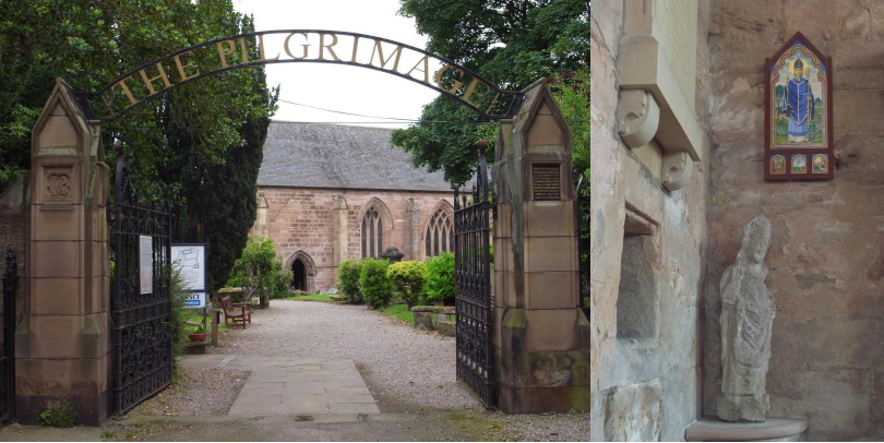
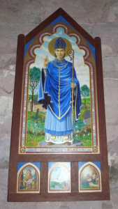 Who was St Duthac? Although little known today he was once a popular figure to whom many churches and altars were dedicated, particularly in northern and north-eastern Scotland. According to the Breviary of Aberdeen, St Duthac (1000-1065) was a native Scot. Tradition has it that he was educated in Ireland and died in Tain. A chapel was built in his honour and a sanctuary established at Tain in the 13th century, ministered by the Norbertine canons of Fearn Abbey. After many years his body was found to be incorrupt and his relics were translated to a more splendid shrine at the Collegiate Church of St Duthac, built between 1370 and 1458. The peak of the shrine’s popularity as a place of pilgrimage came around 1500 with the repeated visits of King James IV. After the Reformation in 1560 the building became the parish church of Tain. The Collegiate Church is one of the finest medieval buildings in the Highlands, and inside you can see where the shrine of St Duthac would have been. ‘The Pilgrimage’ is a modern visitor centre built in a 17th century schoolhouse in the churchyard. It tells the story of medieval pilgrimage to Tain in two colourful galleries.
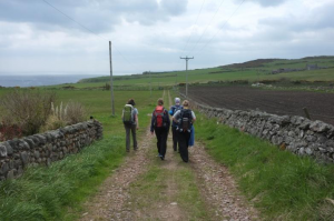
The route can be followed in about 6 days by reasonably fit walkers. The 6 daily stages we suggest here are all between centres of habitation and therefore accommodation, but longer or shorter days are of course possible!
Distance: 146 kms
Terrain: Mainly flat.
Abbreviations:
FP – footpath
KSO – keep straight on
PH – public house
SP – sign posted
WC – toilets
Stage 1 – Aberdeen to Stonehaven (c. 29km, 18 miles)
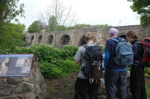 Starting at St Mary’s Cathedral, Huntly St, Aberdeen, walk towards Union St, turn R onto Union St, then L (at the bookshop) onto Bon Accord St. Walk downhill, cross Springbank Terrace, then continue uphill (veering R) past the Ferryhill House hotel on your left. Keep straight on at crossroads onto Whinhill Rd. Pass police station on R, continue down Great Southern Rd (Duthie Park on your L) to the roundabout on Riverside Drive. From here, keep on the N side of the river – i.e. do not cross the bridge but turn right and walk along the riverside path to the old Bridge of Dee. Cross the bridge. At the far end of the bridge, some steps one the right lead to a green area with an interesting notice about the history of the statue of Our Lady of Aberdeen, which was once housed in a chapel very near here. Turn right along the South Deeside Rd (B9077). Just after the last houses and immediately after the road crosses a burn, take the minor road up to the left (SP Causey Mounth). Continue on the road, climbing steadily. At the crossroads, keep straight on, passing a school, and continue straight to Duff’s Hill. When the paved road ends at a T-junction (farm buildings on R), continue straight on on a gravel track, passing a stone circle on the R. Keep straight on down the hill. At the T-junction, turn L, pass hotel/restaurant on L, and in 500m cross the A90 dual carriageway via the bridge (with care – 2 roundabouts). On the other side, veer R at the roundabout (SP Portlethen village). At T-junction, turn L (SP Portlethen station). When you reach the station (ahead of you), keep right. The road crosses the railway line and you then continue, passing Portlethen Church on R, on the minor road which veers R to old Portlethen village. When you reach the PH, the road veers L. Take 1st R after the PH (Old Coast Rd). This becomes a track which turns R then L through farmyards (can be muddy and worse!). At the next farm, keep straight on on the path towards Downies village (visible ahead). In the village, turn R (uphill) at the ‘Spootie’ (old water pump), then after 200m turn L just after the yellow house (‘New Mearns’) (look for Nave Nortrail FP sign on lamppost) onto a track which then becomes a good FP (keeping R at green water treatment block). This path continues, skirting the east side of Cran Hill (keep L at a fork) . When Newtonhill becomes visible ahead and as the track turns inland, 100m before you reach a barn look for a grassy track which turns hard L. This turns into a path which goes down along the edge of a field before descending steeply. Cross the (new) bridge at the bottom and follow the path steeply up the other side, passing fishing huts, into Newtonhill.
Take the minor road (2nd on R at the top – Skateraw Rd) heading inland (W). Continue up Hillhead Rd to cross the railway line at a bridge just after some shops. Straight after the bridge, turn L (opposite the parish church). This road becomes a path at the end of the houses. Follow this track and path (keeping L at a junction – follow the Nave Nortrail FP signs) over a small ford and into Muchalls village. KSO through the village. Before a new housing estate, take the road (Walker Drive) up to the busy A90 dual carriageway. We have sought in vain for an alternative to the next section – it’s not that bad (really!) and the path off to the left of the road is perfectly safe. Follow the A90 round the Muchalls bends to the turn-off for Stonehaven (after 3.5km). Follow the road down (walkers/cyclists are protected at first, but the section before going under the railway line has no verge), entering Stonehaven.
Stonehaven – attractive coastal town, birthplace of Robert Thomson, inventor of the pneumatic tyre, and setting for the annual Hogmanay fireballs ceremony.
Stage 2 – Stonehaven to Inverbervie (c. 19km, 12miles)
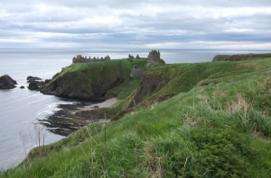 In Stonehaven, head for the harbour and then look for the walkers’ signs to Dunnottar Castle (go R along a lane after the Marine hotel, then veer L). The path (steep) up the brae has recently reopened following landslides. Join the minor road coming from the right, and 100m later fork L on the FP to the War Memorial. If not closed due to landslides, the continuation of the path from the War Memorial, along the cliffs to Dunnottar, makes for pleasant walking (the alternative being via the minor road to the right which takes you to the lodgehouse*). The castle itself is well worth a visit if time permits.
William Wallace, Mary Queen of Scots, the Marquis of Montrose and the future King Charles II, all graced the castle with their presence. Most famously though, it was at Dunnottar Castle that a small garrison held out against the might of Cromwell’s army for eight months and saved the Scottish Crown Jewels, the ‘Honours of Scotland’, from destruction.
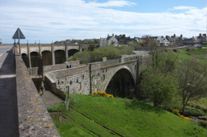 From the castle take the FP inland to the lodgehouse* and car park. Turn L on the road, and reach the main A92 road (turn L). Cross to the right side of the road and walk along the verge (quite wide but rough underfoot) of the A92 for 2.5 km (care – there can be a lot of traffic). Turn L onto a minor road at Uras Knaps (SP Crawton). After 500m, at a no through road sign, turn R onto minor road. Keep straight on to the entrance to the village of Catterline, passing St Philips Episcopal church on the right (often open – do have a look inside – WC) (PH in Catterline, closed Mon/Tue). Before the village, turn R over a bridge (following cycle route signs), passing a cemetery, and 200m later turn L. 500m later, turn L on another minor road. Pass Bellfield farm. Continue on this minor road, ignoring all turns, passing Kinneff church on the L, until it veers R down to the A92 1.5km before Inverbervie. Turn L and continue on the verge on the right of the road. Before the entrance to the town, look for steps down to the old bridge. Cross the bridge and then keep L up to the Cutty Sark monument.
The Cutty Sark, one of the last and fastest tea clipper ships and now moored at Greenwich, was designed by Hercules Linton, a native of Inverbervie.
Stage 3 – Inverbervie to Montrose (c. 23km, 14miles)
Head down towards the coast (turn L off the main street at the Fire Station) to join the path to the R (just after Hall Green Rd) along the line of the old railway line. Follow the path to Gourdon (2km), turning L (following cycle route signs) then R to enter the village. After Gourdon, continue on the coastal path to Johnshaven (SP Off road cycle route), a further 4km (ignore path closed sign – the bridge has now been restored). Johnshaven – WC in caravan park reception block on R. KSO at Johnshaven harbour, passing The Anchor hotel up to your R, then keep L of wall on a path (FP sign) to shortly rejoin road. Continue on the coastal FP, passing conglomerate rocks and old lime kilns, for another 2km, passing Nathalan school up to the right, to Seagreens. Keep L (along coastal FP), then go round to the L at caravan park, to walk along a pebbly path, cross a bridge and continue on a grassy/shingly track/path to Tangleha’ (local artists work here).
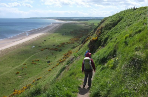 From Tangleha’, take the minor road leading inland and uphill. Due to erosion, the cliff path from here to St Cyrus is closed, so when you reach West Mathers farm turn L to pass in front of the farmhouse and join a track leading W towards a house, from where the track turns R to go up to the main A92 road. Turn L along the main road, then after 300m turn L (SP Nether Woodston) on to a minor road, which turns R at the farm to enter St Cyrus at the parish church. Turn L immediately after the church (SP Montrose 6) and walk towards the coast. Walk down (L at benches) to the shoreline (take care – erosion has damaged the path in places), turning R at the bottom to follow the grassy track past the old cemetery and then on to the Visitor Centre (WC) and car park at Warburton. Continue on the minor road for 2km towards the railway viaduct, passing Steptoe’s Yard. Go under the viaduct and veer R then look for the cycle route sign on the R to take you up and on to the viaduct.
Walk across the viaduct and continue on a grit track, largely along the line of the old railway line, with a section alongside the road at first, following the cycle route signs, into Montrose. Follow the signed path, turning L at a T-junction (industrial unit ahead), then R to head S again (with Montrose church spire in the distance ahead).
You are now crossing Montrose Air Station, Britain’s first operational military airfield, dating back to 1913.
At the edge of a wood, the path turns L then right again. At a sports ground, turn R onto a concrete road, then turn L (cycle route sign). When into housing area, turn L into Rosehill which becomes Mount Rd and then Mill St, from where Montrose High St is but a short distance to your right.
Montrose is a town with a wealth of architecture; its skyline is dominated by the 67m steeple (built 1832-1834). The town has a view of the largest inland salt water basin the UK, a nature reserve of international importance.
Stage 4 – Montrose to Arbroath (c. 24km, 15miles)
Leave Montrose by the road bridge (A92 S, SP Arborath) and continue until you reach a roundabout (railway above you to the right). Turn L (SP Ferryden). Just past the ‘Ferryden’ sign, cross the road and go up some steps (in a clump of trees) on the right. After the 1st set of steps, go left along an old road. After the school, turn R at a T-junction onto a minor road. Follow this road as it rises gently. Just past Balkliellie farm, turn L (SP Usan, Boddin). Pass the entrance to Dunninald Castle on the right. Keep right past the
former main entrance to the castle (cycle route 1 joins on minor road from the left). Pass Yew Cottage. 500m later, at the crossroads, turn L (Weight Limit sign on road), continuing to follow the cycle route signs. The road descends to cross the railway line and enter Lunan. The cycle route sculpture/marker here says Montrose 6, Arbroath 9. It is worth going down into Lunan itself (turn L), where there is a café at Lunan farm (open 0900-1700 except Wednesdays).
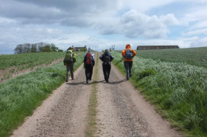 You will need to go back up to the road to leave Lunan. Cross the bridge. After 200m, there is a path leading up to Red Castle off to the left. From the castle ruins, look for a narrow path running south and parallel to the shore. This leads down to a gate. Turn L to the beach at Lunan Bay. Walk along the beach (tide permitting), the shoreline, or the rough (gets rougher) track just above the shoreline. At ‘Corbie Knowe’ (collection of huts and caravans), leave the shoreline to head inland along a track alongside a burn. 500m later, at New Mill, keep left (ford and footbridge over burn) past some cottages (one called ‘Bothy’). The track rises gently to a farm (North Mains) – turn R here at a T-junction onto a minor road. 500m later, at another T-junction, turn R again. 500m later, at another T-junction, turn L to re-join cycle route 1. Continue on minor road for 1 km to Rosehill farm. Just past the farm, turn hard R back towards the farmhouse, then left along a clear track between fields. Pass Drunkendub farm (L then R) and 500m later arrive at a minor road crossroads. Take the wide forest track ahead of you, across the West Woods of Ethie. At the end of the woods, turn L along a rougher track which takes you in 300m to a minor road. Turn R. Follow this minor road all the way in to Arbroath, keeping straight on past a minor road on left to Auchmithie. After the school, the cycle route goes off to the left – we suggest keeping straight on and down into the centre of Arbroath (the Abbey (open 0930-1730) is visible off the road to the right as you enter Abroath).
Arbroath is notable as the home of the Declaration of Arbroath, a declaration of Scottish independence made in 1320. It is in the form of a letter submitted to Pope John XXII, dated 6 April 1320, intended to confirm Scotland’s status as an independent, sovereign state and defending Scotland’s right to use military action when unjustly attacked. Arbroath Abbey, once the richest in Scotland, was founded in 1178 by King William the Lion and dedicated to St Thomas Becket, whom the king had met in England. Arbroath is also home to the Arbroath Smokie (smoked haddock), and its football team holds the world record for highest number of goals in a professional football match 36-0 against Aberdeen Bon Accord in the Scottish Cup in 1885.
Stage 5 – Arbroath to Dundee (c. 32km, 20 miles)
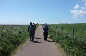 Make your way down to the double harbour. From the harbour head W to pass between the RNLI building and the modern Harbour Visitor Centre (WC and tourist information centre). Pass Arbroath Museum, housed in the distinctive Signal Tower building. Follow the surfaced path around Inchcape Park to follow the sea wall past the football ground and then West Links recreation area with paddling pools and then Kerr’s Miniature Railway. Continue on the coast path, do not take the signed path for Elliot, but go straight on, crossing a bridge over the Elliot Burn and then following a path next to the railway line and also a lagoon on the left, passing a level crossing. The surfaced path continues as far as East Haven (dating back to 1214, one of Scotland’s oldest recorded fishing villages). At the picnic area (WC), turn r to go under the railway, then turn L (SP
Carnoustie) along a surfaced track running to the right of the road. At some farm buildings, cross to the other side of the road, pass the Liz McColgan sports centre and enter West Haven. Follow the Angus Coastal Path signs (WC in housing estate) to re-join the coast at Carnoustie.
Continue on the path/track along the coast (SP Angus Coastal path), passing to the right of the golf course hotel, continuing along the surfaced track alongside the railway line, passing Golf St station to Barry station. Continue on the track alongside the railway – Barry Links military zone is over to the left. Reach Monifieth (WC at play area). Walk along the coast path/road, crossimng the bridge over the Dighty Water (following the cycle route all the time). Continue along the coast path into Broughty Ferry and its castle standing on a headland. Pass the castle across a play area, and continue along Risher St/Ambrose St, keeping to the shoreline all the time (and following the cycle route signs). The excellent coastal path brings you as far as the Port of Dundee, where you have to follow the road up to the R, then turning L along the main road into the centre of Dundee.
Dundee is the fourth-largest city in Scotland. The town developed into a burgh in Medieval times, and expanded rapidly in the 19th century largely due to the jute industry. This, along with its other major industries (Dundee marmalade and home to the Dandy, Beano, Desperate Dan, Oor Wullie) gave Dundee its epithet as the city of ‘jute, jam and journalism’. Today, Dundee is promoted as ‘One City, Many Discoveries’ in honour of Dundee’s history of scientific activities and of the RRS Discovery, Robert Falcon Scott’s Antarctic exploration vessel, which was built in Dundee and is now berthed in the city harbour.
Stage 6 – Dundee to St Andrews (c. 29km, 18miles)
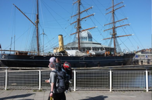 Make your way to the Tay Bridge. The easiest way is from the Discovery ship and exhibition (neat the railway station), going behind the leisure centre and along to the bridge where steps (or, if you prefer, there’s a lift) lead to the central walkway on the bridge. At the end of the bridge (noisy and boring – guessing how many sets of lamp posts there are going to be can add interest!) – turn left for the underpass which leads to a car park area (snack bar, toilets). From here, join the Fife Coastal Path by heading east towards a yellow Y-shaped sculpture. Go down the steps, cross the road and turn R. After 150m, fork left onto a surfaced track. In 400m, keep left through a car park/layby. Continue on track to side of road, then veering L towards the shore and a lighthouse. Continue on what is a former railway line. After 500m, when you are on a bridge, go down some steps on L immediately after the bridge to join a track coming under the bridge. 50m later turn hard R onto a lower track which follows the shoreline. Keep straight on, keeping left on track. Veer right then left over what appear to be former bridges (left at ‘Fairy Lane’). Follow path down to the shore and in to Tayport (‘Harbour café’ on right.).
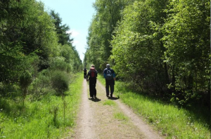 Follow the line of the harbour wall (L then R). Keep straight on through houses (following Fife Coastal Path signs all the time). Continue through a caravan park (toilets open to the public 0900-1600). The road veers R (car park to L). Turn L (Shadwell Rd South) after shop. Cross Lundin Bridge and keep straight on on good path. Just before a line of tank traps (concrete cubes), fork right towards Tenstmuir forest (cycle route 1 marked). After a green gate, arrive at a T-junction – turn R on to a track which then follows the edge of the forest for 1.5 km. Keep straight on at ‘Junction 6’ (SP Moreton Lochs), ‘Junction 7’ (SP
Tentsmuir Car Park) and also at ‘Junction 8’. The track continues more or less straight for 2km. At the T-junction with the road, turn L, then after 50m turn R on to another forest track (SP Leuchars, Fife Coastal Path). The woods gradually open out. At end of woods, go through a small gate and cross grassy moorland on a clear path (marker posts visible at intervals). Continue to follow the Fife Coastal Path signs, veering R at a gate along the line of a fence (the boardwalks are welcome!). Follow the path between fences for 160m, turn R on to broad track, veer left, Leuchars airfield now on your left. Continue on this track towards a farm and the radar tower. Reach the airfield perimeter fence and continue on the track past a private old house (Earlshall), complete with mock sentry box. When you reach a T-junction, the Fife Coastal Path (and our route) turns L, but a right turn is recommended to visit the church of St Athernase.
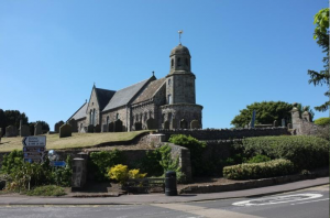 The beautiful Romanesque church of St Athernase Church, Leuchars, is well worth a visit. The stunningly decorated chancel and apse, with its blind arcading and Norman arches, have been described by one commentator as “the second finest piece of Norman work in the whole of Great Britain”†, the effect being like “a wedding cake in stone”, still looking much as it would have done to the masons who constructed it nearly 830 years ago. “Athernase” is probably an anglicised form of the name Itharnán, found also in Fife at Kilrenny, and on the Isle of May, an Irish missionary who “died among the Picts” in 669 according to the Annals of Ulster.
[† after Durham cathedral]
Returning to the T-junction, continue on the road through the military housing of Leuchars, to join the main A919.
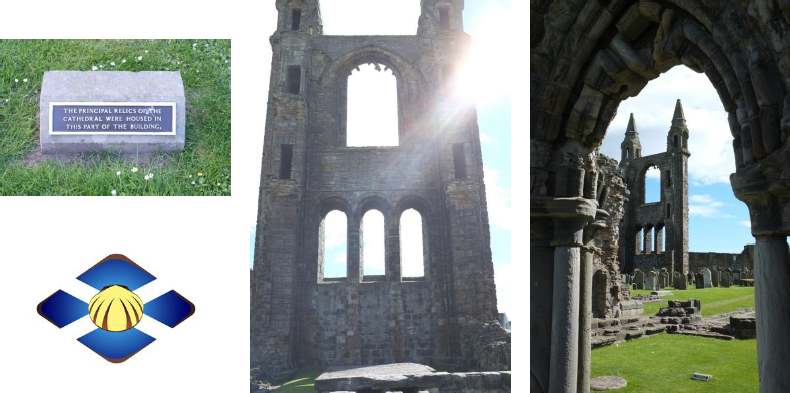
Follow the Fife Coastal Path signs (across an old bridge and into a housing estate to the right) to Guardbridge. In former times, this was the last gathering point for pilgrims before the final walk into St Andrews. Cross by the old bridge (now closed to traffic), and follow the cycle route surfaced track (to the left of the road) all the way into St Andrews. When you reach the Old Course hotel, look for a gravel track a few metres to the left and continue into St Andrews. It is recommended that you follow the brown signs for the cathedral and continue straight ahead, along North St, to the cathedral ruins (open 0930-1730) and your pilgrimage destination. The catholic church of St James the Great, 17 The Scores (to the north of North St), fittingly dedicated to the patron saint of pilgrims, St James (Santiago de Compostela) is a good place to rest, reflect and give thanks for your completed pilgrimage.
Accommodation Suggestions
Stonehaven – numerous bed and breakfasts and small hotels. Campsite. Groups might ask about possible sleeping on floor of the ‘Soup Kitchen’ next to church of the Immaculate Conception – stonehaven.stmarys@btinternet.com 01569 762433.
Inverbervie – several bed and breakfasts (incl. The Laurels 01561 362604), Crown Hotel 01561 361213). Campsite.
Gourdon – Harbour Bar bed and breakfast.
Johnshaven – Seaforth bed and breakfast on R at entrance to village.
St Cyrus – Old Fishing Station bed and breakfast.
Montrose – numerous bed and breakfasts, hotels. Boswell House (ecumenical retreat centre) 107 High St 07919 951021 or 01342 834249 judithirving@btinternet.com
Arboath – numerous bed and breakfasts (incl. Harbour Nights 01241 434343, Kingsley Guest House 01241 873933). Campsite. St Thomas of Canterbury church friendly 01241 873013 and may advise on accommodation.
Dundee – accommodation of all types. Premier Inn is close to the Tay Bridge and the Discovery. Backpackers Hostel – 71 High St, DD1 1SD. 01382 224 646, is in a renovated building dating partly from the 16th century www.hostelworld.com/hosteldetails.php/Dundee-Backpackers-Hostel/Dundee/24982
St Andrews – accommodation of all types, on the expensive side and often difficult to find at weekends. Tourist Hostel (summer only, recommended!) – Inchape House, St Mary’s Place, KY16 9QP 01334 479911 www.cowgatehostel.com/st-andrews/
A Pilgrim Prayer
O God, who brought your servant Abraham out of the land of the Chaldeans, protecting him in his wanderings, who guided the Hebrew people across the desert, we ask that you watch over us, your servants, as we walk in the love of your name to St Andrews.
Be for us our companion on the walk,
our guide at the crossroads,
our breath in our weariness,
our protection in danger,
our shelter on the way,
our shade in the heat,
our light in the darkness,
our consolation in our discouragements,
and our strength in our intentions,
so that with your guidance we may arrive safe and sound at the end of the road and enriched with grace and virtue return safely to our homes filled with joy.
In the name of Jesus Christ our Lord, Amen.
St Andrew, pray for us.
St Duthac, pray for us.
Our Lady of Aberdeen, pray for us.

